


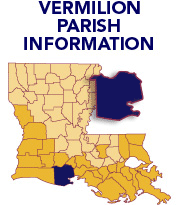
Vermilion Parish--What HappenedAt approximately 2 a.m., Sept. 24, the center of the eastern quadrant of Hurricane Rita blew over Vermilion Parish. Buffeted by wind speeds between 70 and 100 mph, an initial storm surge of approximately 20 feet flooded the southernmost coastal areas of the parish. However, as southerly winds persisted over Vermilion in the southeast, a second storm surge of 10 to 13 feet pushed seawater (and sea life) 8 to 10 miles north upland, inundating the parish floodplain south of Abbeville. Devastated communities in the southern two-thirds of the parish included the incorporated towns of Erath and Delcambre, as well as the unincorporated marsh island communities known collectively as Les Iles Des Acadians. Approximately 16,000 residents fled the parish prior to the storm under a mandatory evacuation order for all homes south of Louisiana Highway 14. Nevertheless, up to 1,000 people returned after the first storm surge retreated (and before the hurricane evacuation order was rescinded) and became stranded when the second storm surge struck. Over the following days all were rescued, and although no one was reported killed or injured in Vermilion Parish, an estimated 10,000 cattle, horses and other livestock perished. Access to the floodplain was restricted to boats until Sept. 27 when floodwaters retreated. Besides water and wind damage to buildings, secondary impacts included: saltwater contamination of fields, soil and animal feed; mold contamination of houses, public buildings, and hay; fire damage; crop devastation; housing and employment shortages; coastal erosion; habitat loss; canal/drain blockage and debris; increased population of mosquitoes from standing water; and economic uncertainty in rice and seafood industries. Oil and gas production were largely unaffected. Sources
|