Louisiana Long-Term Recovery Home Page
Recovery Process Recovery Projects Planning by Parish Planning by Sector Funding Opportunities Implementation
spacer
Map
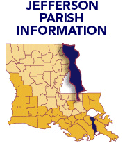
Click on a parish to change parishes.
   OVERVIEW 
   RECOVERY VISION 
   RECOVERY GOALS 
   RECOVERY PROJECTS 
   RECOVERY PROJECT LOCATIONS
   PARISH PLANNING BASELINE
     What Happened 
     Needs Assessment 
     Current Planning Efforts 
     Priority Issues 
   COMMUNITY INVOLVEMENT 
   PHOTO GALLERY  |  LIBRARY 
   
   
  Print Icon  PARISH PLAN 
  Print Icon
Vernon Beauregard Allen Calcasieu Cameron Jefferson Davis Vermilion Iberia St. Mary East Baton Rouge Lafourche OrleansSt. TammanyWashington Tangipahoa St. Bernard St. Charles Jefferson PlaqueminesView Interactive Map Sabine Terrebonne Acadia Lafayette St. Martin St. MartinAssumptionSt. JamesSt. John the Baptist
Divider

Jefferson Parish - What Happened

A mandatory evacuation order was issued by the Jefferson Parish President on Aug. 26, 2005, for Hurricane Katrina. Three days later, the storm crossed southeastern Louisiana, approximately 20 miles east of Jefferson Parish, with wind gusts reaching 100 to 125 mph.  Storm surges of up to 15 feet severely flooded areas in the southern part of the parish. Heavy rains and overtopping of the Lake Pontchartrain levees resulted in flooding in the northernmost sections of the parish, and sections of “Old Metairie” remained flooded for weeks.

On Sept. 27, 2005, Hurricane Rita hit the western part of the state, bringing sustained winds of 45 mph to Jefferson Parish.  Storm surges again flooded areas of southern Jefferson Parish, particularly around the town of Jean Lafitte.  Utilities were disrupted throughout the parish and most commerce was halted for several weeks. High winds damaged more than 26,700 residential roofs throughout the parish.

spacer spacer spacer spacer
 
Recovery Process | Recovery Projects | Planning by Parish | Planning by Sector | Funding Opportunities | Implementation
    Homepage   Copyright 2006