|
| |
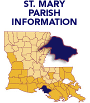
Click on a parish to change parishes. |
| |
|
| |
|
| |
|
| |
|
| |
|
| |
PARISH PLANNING BASELINE |
|
|
|
|
| |
|
| |
| |
| |
|
| |
|
| |
 |
|
|
 |
St. Mary Parish
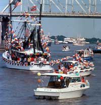
Today the “Gulf Coast Highway” helps define this coastal parish. US 90 runs the length of St. Mary, passing through small towns and big ports. From turn of the century farm life in Franklin to the modern port in Morgan City, the parish offers a diversity of experiences. In Morgan City, both shrimp boats and supply ships for offshore oil rigs frequent the docks. Fishing and support for offshore mineral exploration are key revenue sources.
St. Mary Parish is blessed with natural resources. Huge salt deposits are mined underground. The southern edge of the Atchafalaya Basin reaches into St. Mary. The Delta National Wildlife Refuge, one of the larger refuges in the state, occupies the southeast corner of the parish. The refuge is an important habitat for migratory waterfowl, marine life and the Eastern Brown Pelican - Louisiana’s state bird.
When asked what they most valued about their parish, residents responded:
“We treasure our history, culture and historical sites such as G. W. Hamilton School and Charenton Park.” |
|
 |
- St. Mary Parish has 612.8 sq. miles in land area and a population density of 85.2 per square mile. In the last three decades of the 1900s, its population declined by 11.9%.
- The average household size is 2.74 persons compared to an average family size of 3.23 persons.
- In 2004 manufacturing was the largest of 20 major sectors. It had an average wage per job of $41,546. Per capita income grew by 33.4% between 1993 and 2003 (adjusted for inflation).
- The parish seat is Franklin.
- Larger communities are Baldwin, Berwick, Charenton, Franklin, Morgan City, and Patterson.
- The parish was named for an ecclesiastical district of the Catholic Church.
- Pre-storm, the population was 52,000.
- Significant economic interests are support for oil and gas exploration and operations offshore, Public Administration (local government and schools), industrial warehousing, sugarcane, aquaculture (crawfish), fishing, manufacturing and maintenance of equipment, gambling tourism, retail.
|
|
|