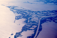
Louisiana Long-Term Recovery Home Page
Recovery Process Recovery Projects Planning by Parish Planning by Sector Funding Opportunities Implementation
spacer
Map
Click on a parish to change parishes.
   OVERVIEW 
   RECOVERY VISION 
   RECOVERY GOALS 
   RECOVERY PROJECTS 
   RECOVERY PROJECT LOCATIONS
   PARISH PLANNING BASELINE
     What Happened 
     Needs Assessment 
     Current Planning Efforts 
     Priority Issues 
   COMMUNITY INVOLVEMENT 
   PHOTO GALLERY  |  LIBRARY 
   
   
  Print Icon  PARISH PLAN 
Vernon Beauregard Allen Calcasieu Cameron Jefferson Davis Vermilion Iberia St. Mary East Baton Rouge Lafourche OrleansSt. TammanyWashington Tangipahoa St. Bernard St. Charles Jefferson PlaqueminesView Interactive Map Sabine Terrebonne Acadia Lafayette St. Martin St. MartinAssumptionSt. JamesSt. John the Baptist
Divider

Terrebonne Parish

The Terrebonne Parish Recovery Plan is being converted to the RPT

With 2,066 square miles at the center of Louisiana’s Gulf coast, Terrebonne is Louisiana’s second largest parish. And it’s more than ninety percent wetlands. What this astounding fact means for the people who live here is apparent: their traditional lifestyle is tied to the land, the Gulf and a unique mixture of the two. What Terrebonne means to the nation deserves more explanation - and attention. It’s a restaurant for a half the hemisphere’s migratory birds, a hatching area for a third of the nation’s seafood and, more important than ever, a vital link in a chain of support for America’s supply of oil and natural gas.

Before the parish was officially organized in 1822, trappers and fishermen explored Terrebonne and found bald eagles, fertile soil and every seafood and trapping animal available. In the 1920s, discovery of natural gas began a robust expansion of industry that married the parish economy with mineral exploration. In recent decades, medical, retailing and lighter industrial trades have rounded out the diversity of the area. But Terrebonne will always be tied, for better or worse, to the coast.

A top priority among parish leaders is publicizing the desperate condition of Louisiana’s coast. The Gulf is literally inching toward the doorstep of Terrebonne. Man-made canals slice through the marsh, land is naturally sinking, saltwater intrusion is killing grasses and destroying estuaries as wave after wave of storms smooth the geography. The result? Storm surges are more devastating and there are less barriers to slow hurricanes from tearing into the vanishing coast, laving more destruction father inland than ever before.


quick stats
  • The name "Terrebonne" means "good land" in French.
  • As of the census of 2000, there were 104,503 people, 35,997 households, and 27,393 families residing in the parish.
  • The parish has a total area of 5,387 km2 (2,080 mi2). 3,250 km2 (1,255 mi2) of it is land and 2,137 km2 (825 mi2) of it is water. The total area is 39.66% water
  • Terrebonne Parish was formed in 1822 from part of Lafourche Parish.
  • The bayou city of Houma is the seat of Terrebonne Parish.
  • As of the 2000 census, Houma had a total population of 32,393.
  • The city's powers of government have been absorbed by the parish, which is now run by the Terrebonne Parish Consolidated Government.
  • Houma is also known, although not as well as New Orleans, for its Mardi Gras festivities.
  • Though Houma is quickly changing and developing, many of the residents of the surrounding small communities make their living as their ancestors did. They are shrimpers, oystermen, crabbers, fishermen, and trappers.
  • spacer spacer spacer spacer
    Staff Login  
    Recovery Process | Recovery Projects | Planning by Parish | Planning by Sector | Funding Opportunities | Implementation
        Homepage   Copyright 2006