|
| |
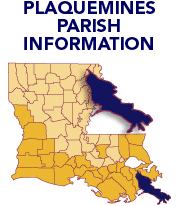
Click on a parish to change parishes. |
| |
|
| |
|
| |
|
| |
|
| |
|
| |
PARISH PLANNING BASELINE |
|
|
|
|
| |
|
| |
| |
| |
|
| |
|
| |
 |
| |
|
|
|
 |
Plaquemines Parish
At the mouth of the Mississippi River, school kids know Plaquemines Parish as the “big toe of Louisiana's boot” protruding into the Gulf of Mexico. The river bisects the parish, meaning you’re never far from either fresh of salt water.
The parish depends on the Gulf for its livelihood. Oil and gas exploration support and fishing - both sport and commercial - are the parish’s two larger industries. Agriculture is another vital source of income. This is the first area explorers French Iberville and Bienville surveyed on their historic voyage in 1699. After the 1927 Mississippi River flood, in which most of the parish was destroyed, farmers embraced a new crop: citrus. Plaquemines oranges, mandarins and satsumas are now shipped throughout the U.S.
The parish is a distinctive mix of Yugoslavian, French, Irish, Italian, German, Spanish Canary Islanders, African-American, Cajun, Native American and Vietnamese people. The distinct cultural heritage is celebrated in Plaquemines with a series of annual festivals.
When asked what they treasured most about their parish, residents responded:
“We treasure our recreational opportunities, including year-round hunting and fishing and quiet communities with small businesses. We want to ensure that landmarks such as Ft. Jackson are safe.” |
|

 |
- The parish was named for the fruit of the persimmon tree.
- Fort Jackson was built in 1822 under the recommendation of General Andrew Jackson and during the Civil War was an important defense of New Orleans.
- Waterfowl hunting in Plaquemines Parish has long been recognized as some of the best in the nation.
- Plaquemines Parish has 844 sq. miles in land area and a population density of 34.3 per square mile. In the last three decades of the 1900s, its population grew by 6.1%.
- The average household size is 2.89 persons compared to an average family size of 3.30 persons.
- In 2004 manufacturing was the largest of 20 major sectors. It had an average wage per job of $57,296. Per capita income grew by 10.5% between 1993 and 2003 (adjusted for inflation).
- The parish seat is Pointe A La Hache, one of the earliest area of the state seen by French explorers.
- Larger communities are Belle Chasse, Boothville, Buras, Empire, Pilottown, Pointe A La Hache, Port Sulphur and Venice
- The pre-storm population was 29,000.
- Significant economic interests are support services for the oil and gas industry, fishing, light manufacturing, shipping, retail and warehousing.
|
|
|