|
| |
Click on a parish to change parishes. |
| |
|
| |
|
| |
|
| |
|
| |
|
| |
PARISH PLANNING BASELINE |
|
|
|
|
| |
|
| |
| |
| |
|
| |
|
| |
 |
|
|
 |
St. Charles Parish
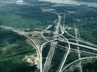
Lying west of New Orleans in the “Plantation Country” of Louisiana, St. Charles Parish contains a bounty of waterways, including lakes, bayous and the Mississippi River. St. Charles’ economy is tied to chemical and oil refining industries, river traffic and sugarcane production.
Settlers to Louisiana’s “German Coast” arrived here in 1721 and fed the struggling colony of New Orleans many times with their crops. Antebellum Destrehan Plantation draws visitors to the east bank of the Mississippi, while excellent fishing and wetlands, abundant with fowl, attract sportsmen to the west bank. Bedroom communities to New Orleans are now growing here just as they did north of Lake Pontchartrain in previous decades.
When residents were asked what they valued most about their parish, they responded:
"We treasure the fact that we are close to the city but can enjoy the open spaces of our rural landscapes. We are proud of our school system.” |
|
 |
- St. Charles has 283 sq. miles in land area and a population density of 176.6 per square mile. In the last three decades of the 1900s, its population grew by 62.7%.
- The average household size is 2.90 persons compared to an average family size of 3.27 persons.
- In 2004 manufacturing was the largest of 20 major sectors. It had an average wage per job of $78,431. Per capita income grew by 8.6% between 1993 and 2003 (adjusted for inflation).
- The parish seat is Hahnville.
- Larger communities are Boutte, Des Allemands, Destrehan, Good Hope, Hahnville, Luling, New Sarpy, Norco, Paradis and St. Rose.
- The parish was named for an ecclesiastical district of the Catholic Church.
- Pre-storm, the population was 50,000.
- Significant economic interests are oil refining and chemical production, Public warehousing, manufacturing, retail, support and employment for international airport.
|
|
|